Page last updated: 27/01/19
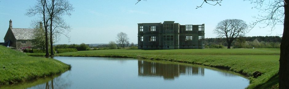
Lyveden New Bield
The Re-Discovery Story
Recovering Sir Thomas’s Dream
In 1995, the areas under the control of the National Trust were only part of the Tresham dream that was abandoned in 1605. Mark was always keen to recover as much as possible of that story, and opportunities arose (or were engineered) that if taken, made that possibility a reality.
A map showing the extent of the National Trust property in 1978 is shown (Map 2) on the ‘Introduction’ page. This map was still applicable in 1995, except that by this time, Bradshaw Wood to the east and south of the property had been cleared, and used for arable production.
From 1996 through to 2012, Mark, on behalf of the Trust, entered into negotiations (primarily with Barnwell Estates) to acquire leasehold agreements, or to purchase, areas of land associated with the Lyveden history. These acquisitions are grouped below into three phases (or time periods).
- First Phase – 1996-2003 Areas with Archaeological Significance
- Second Phase – 2003-2011 Access & Parking Improvements.
- Third Phase – 2011-2012 Acquisition of the Manor House (Old Bield).
Within each section covering each phase, further details are given relating to the individual acquisitions, namely:
- Sheep Field
- Orchard
- Outer Meadow
- Parterre
- New Access Road & Car Park
- Bradshaw Green and Plantation
- Extended Parterre Area
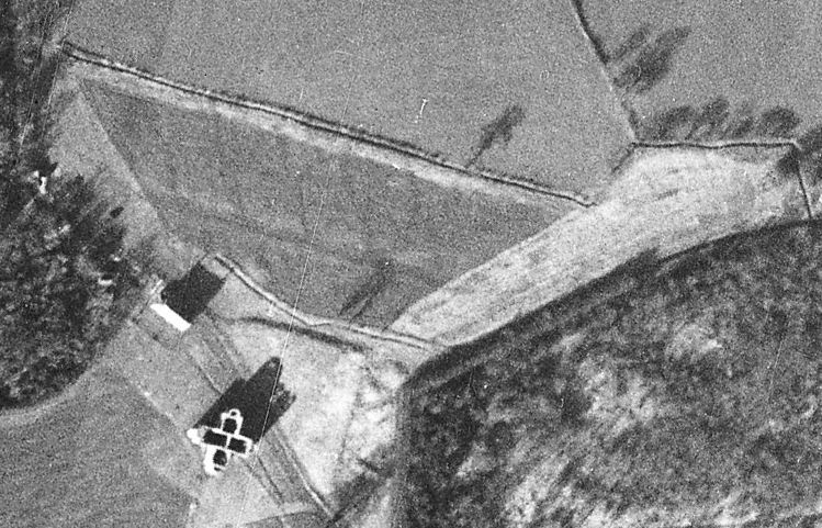
Research carried out by the team at Lyveden confirmed the belief that Sir Thomas’ Elizabethan Garden extended beyond the area then (in 1995) owned by the Trust. In particular, aerial photographs were discovered that not only confirmed the existence of some features, but also identified their location.
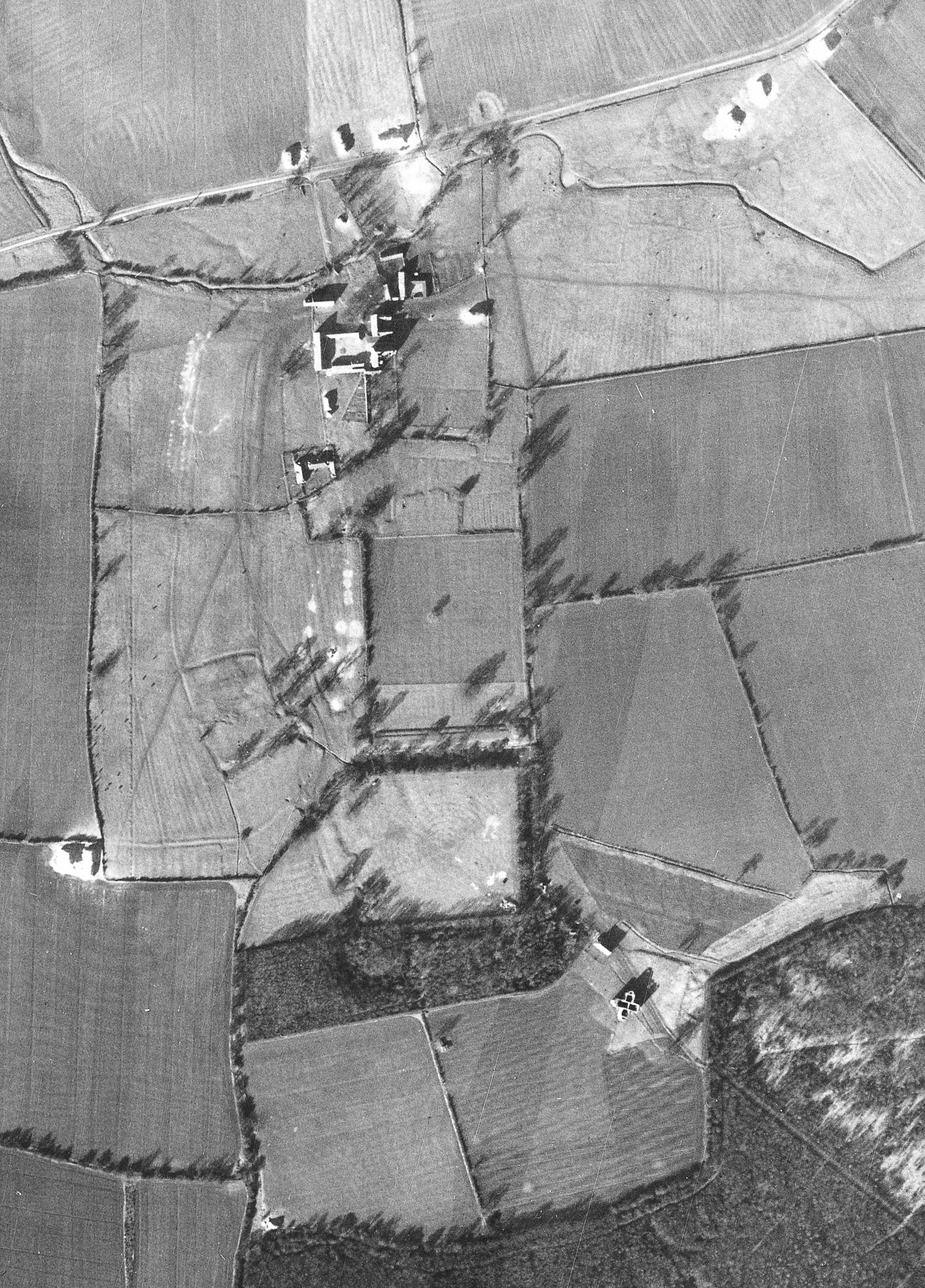
1940s Aerial Image
One aerial photograph stands out as of major significance. Originally believed to be a Luftwaffe reconnaissance image, but later believed to have been taken by the RAF in 1944, this photograph identifies the Parterre, the Labyrinth, and the Orchard. It is also significant in identifying field boundaries and hedges that were in existence at that time. The original photograph covers a large area of land, significantly exceeding the Lyveden area. This image has been created from the original after it has been rotated onto a north/south axis, and its range limited to the Lyveden area and its immediate surroundings. ‘Zoomed in’ images relating to individual areas are used below, and an image of the Labyrinth is shown on the Garden Revealed page.
The following maps were compiled to show the Trust’s property area at the end of these three acquisition phases.
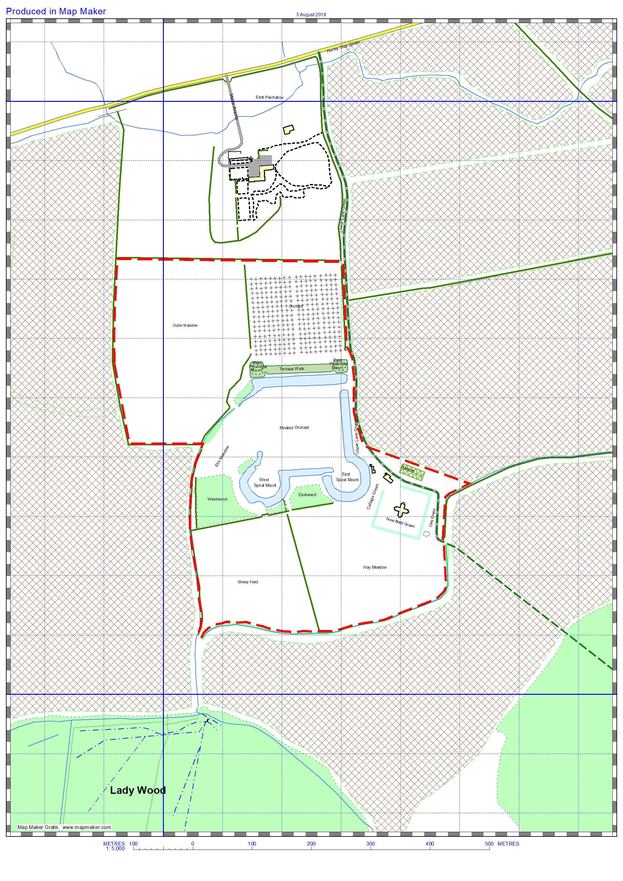
map3 2003
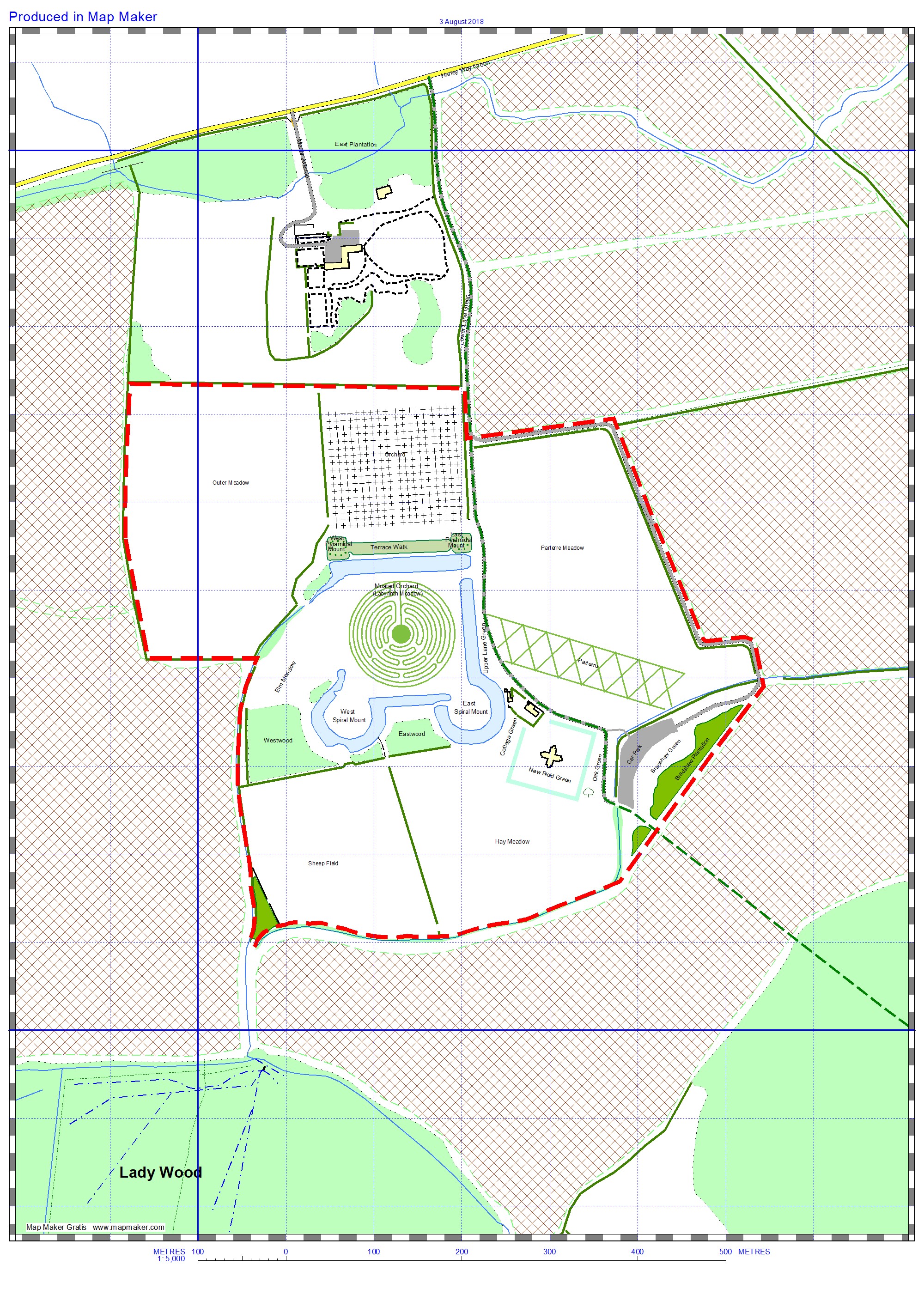
map4 2011
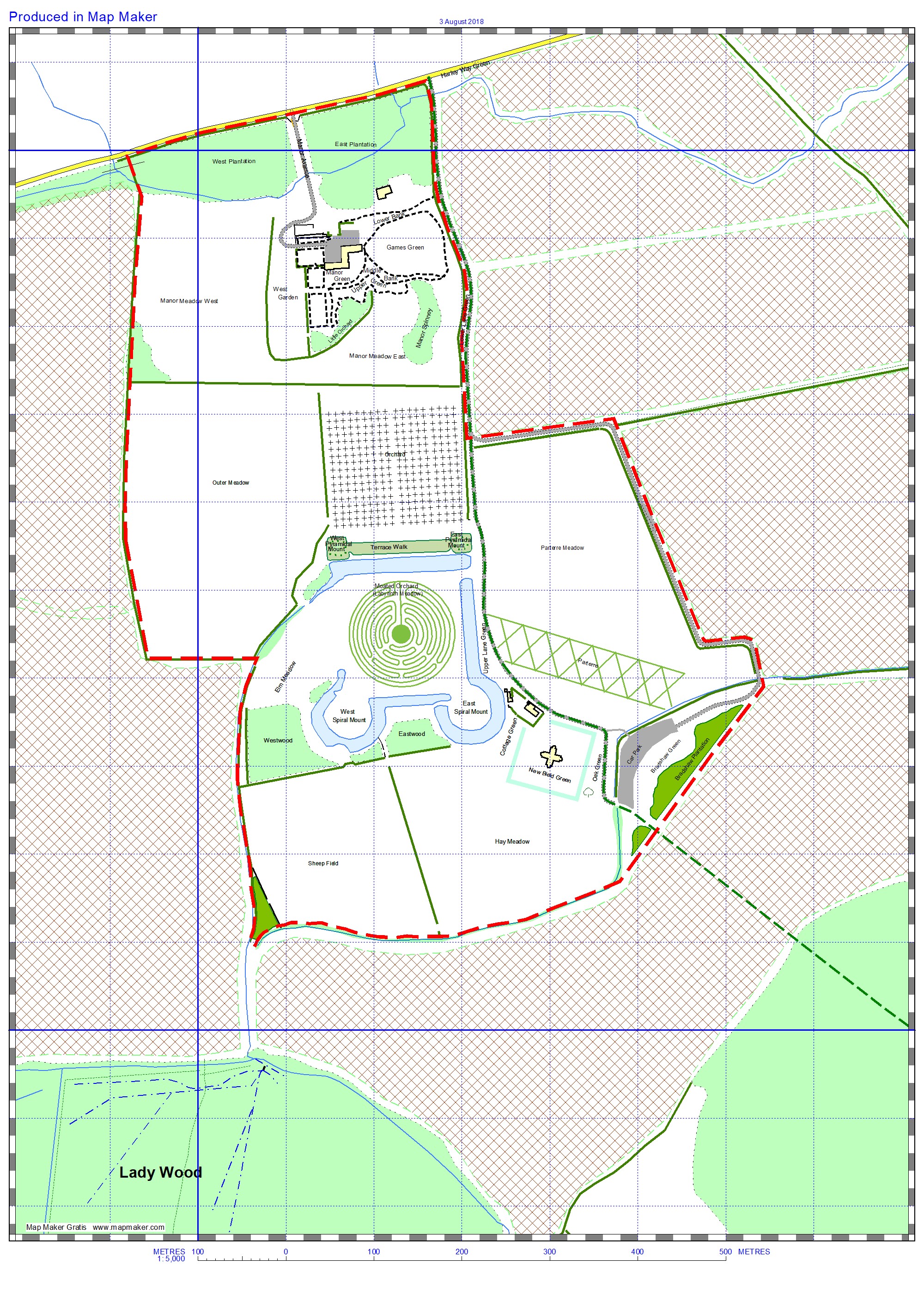
map5 2012
First Phase – Areas with Archaeological Significance.
On a number of occasions from 1996, Mark Bradshaw successfully argued that some areas should be considered to be part of the original garden, or that the setting for the Lodge and Elizabethan Garden was being disturbed by surrounding agricultural operations.
“Over what was probably a 6 year period from 1998, we started negotiating with the Duke’s Barnwell Estate to acquire additional parcels of land which had historic links to the Lyveden gardens.
“We didn’t attempt to go for all the areas in one go, but started with the Sheep Field followed by the Orchard, and then the Outer Meadow and a section of Parterre Meadow.
“This often involved pestering the Duke of Gloucester while standing by his desk in Barnwell going through aerial photographs. His agent, James Garson, was quite understanding, but then a new guy, John Elliott, was appointed, and he was the opposite. Doubtless, he saw his role as protecting the Duke’s interests, and he was generally opposed to any attempts by Lyveden to secure additional land thus diminishing the land holding he was managing. At that time, the land we were negotiating for was to be rented, and the land agent insisted on a rent at the maximum agricultural rate (£110 / acre). £60 an acre would have been more typical at the time, but John’s attitude was that if we wanted it, we’d have to pay for it! However, the land was successfully accepted for Countryside Stewardship, which gave an income to” (partially) “offset the rent charged.”
At the end of this period (c2003), the area of land under the control of the Lyveden team is shown on map3 above.
Sheep Field
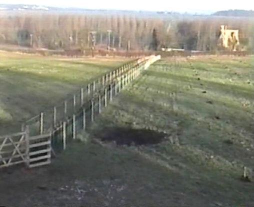
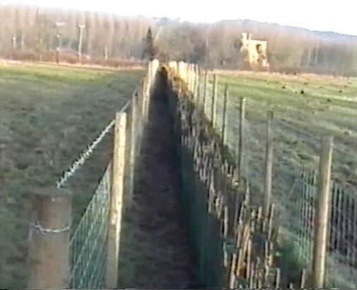
A stock fence was constructed on east and west sides of this field and a boundary hedge planted on the west side together with a small copse (now known as Corner Copse) in the south west corner. This used a similar mix of plants as that used for the hedge.
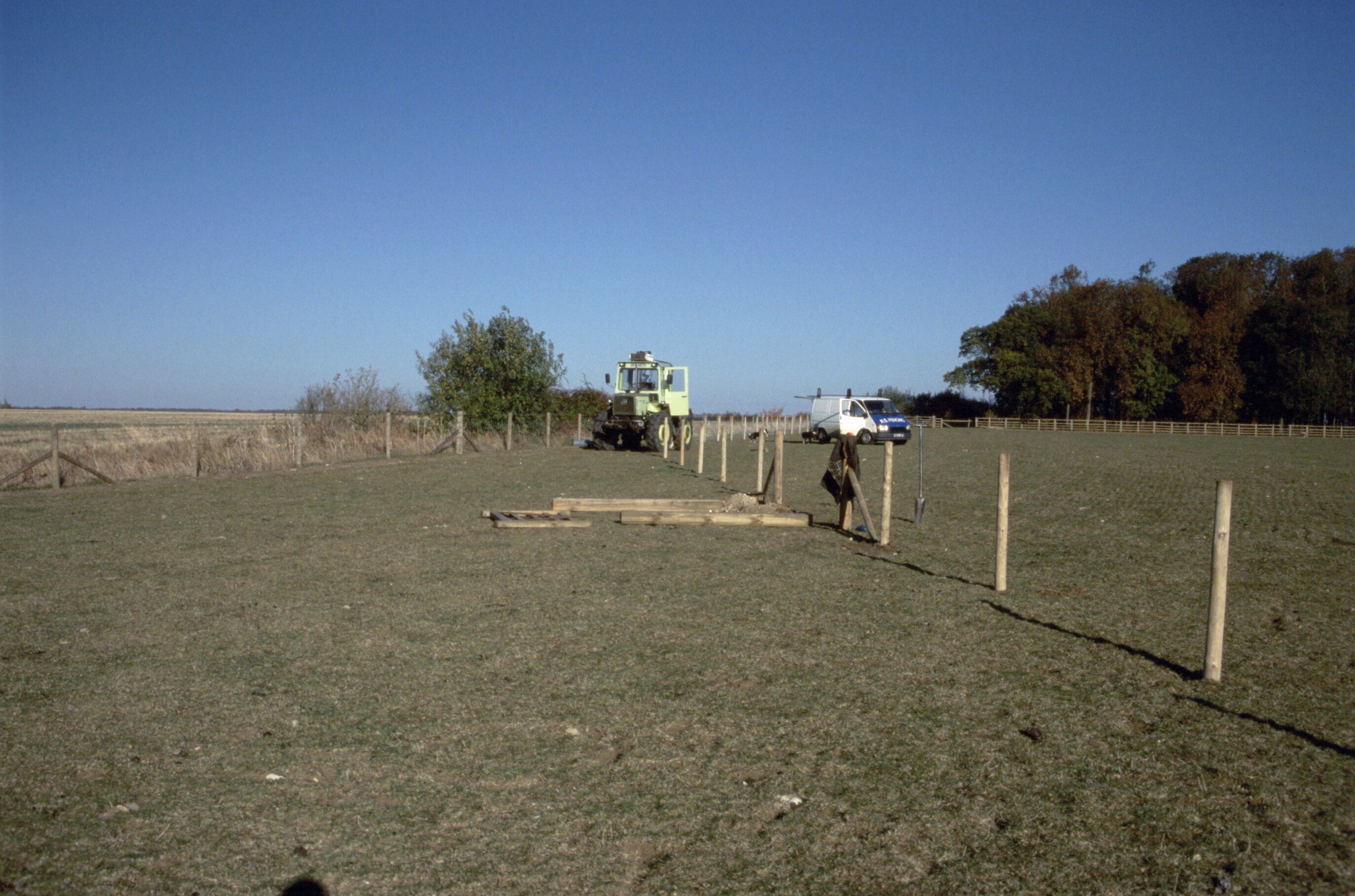
These two photographs show the fence under construction. On the left, a view from inside Corner Copse area looking north; on the right, a view from the sheep field into Corner Copse.
When the moats were dredged in 2000, the spoil was spread over this field.
Orchard
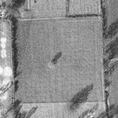
This view of the orchard, taken from the ‘Luftwaffe’ aerial image shown above, appears to show a grid pattern that tends to coincide with Sir Thomas’s planting instructions.
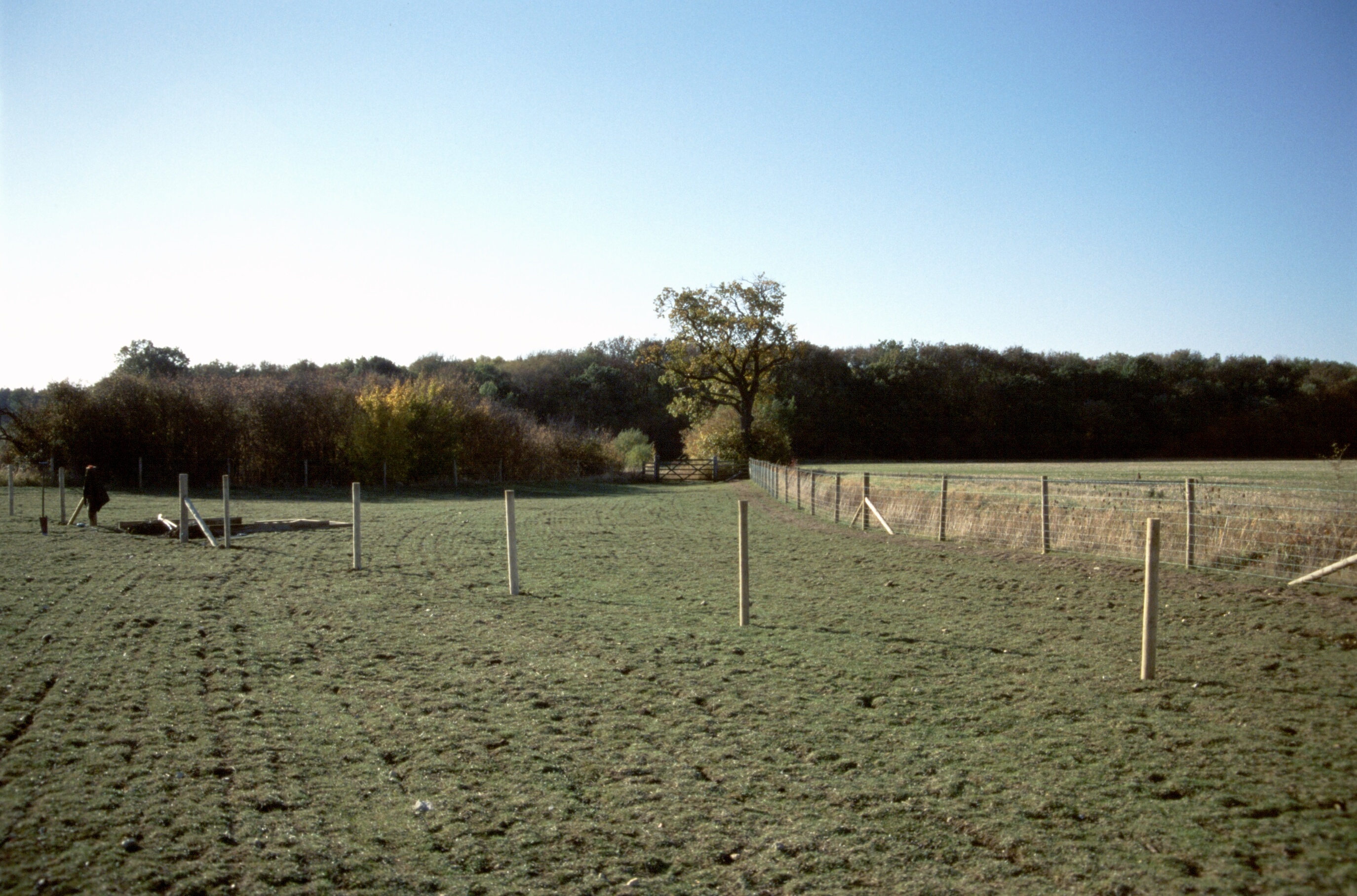
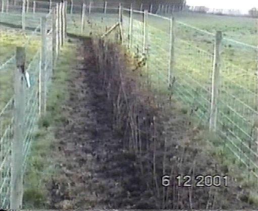
Re-establishing the hedge between the Outer Meadow and the Orchard and Old Manor Green was the first task.
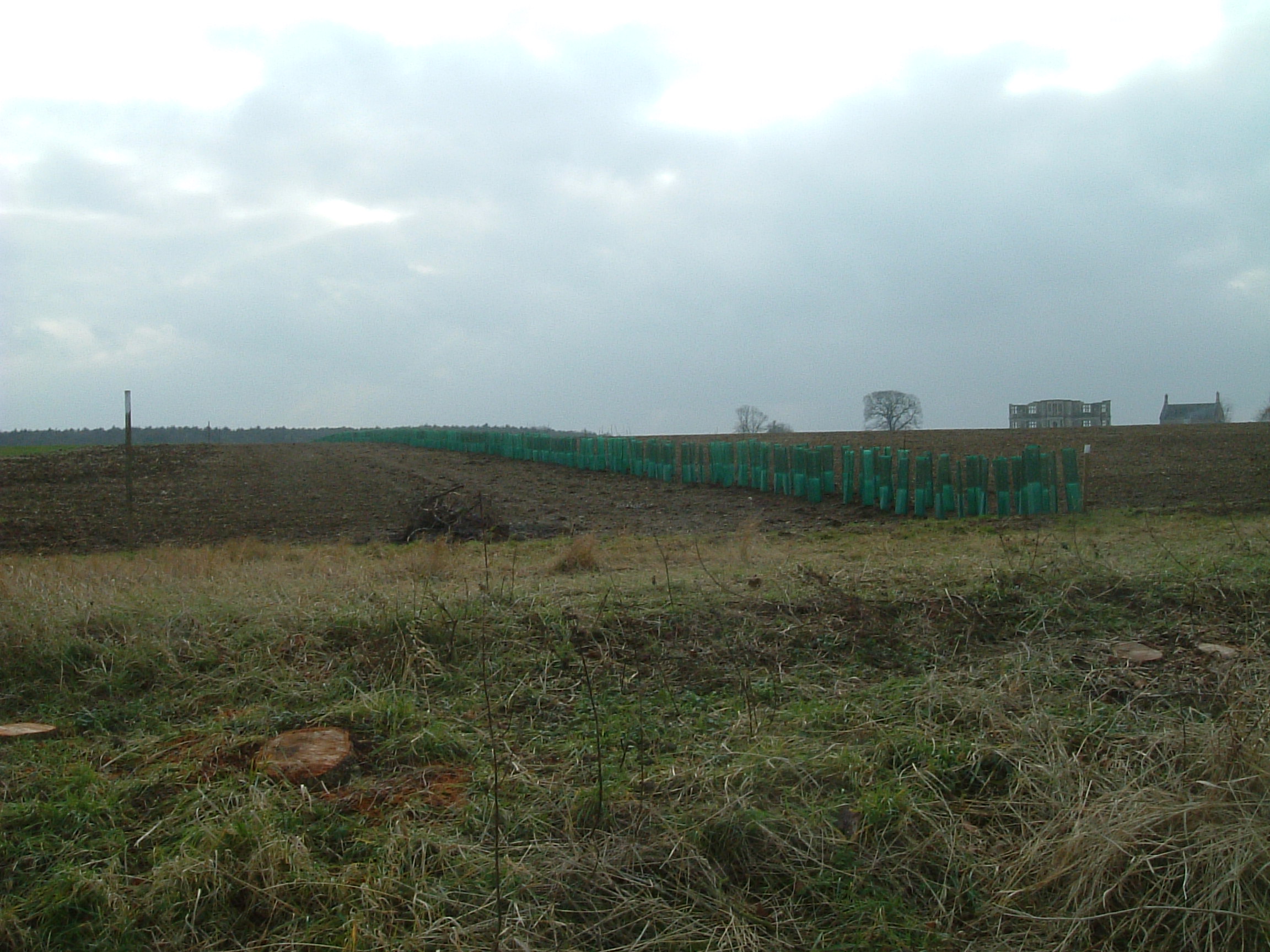
 In 2001, contactors were used to erect stock fencing on both sides of the hedge line to stop/discourage sheep and deer grazing on the new saplings.
This view was taken from the West Pyramidal Mount, looking north towards the Manor House.
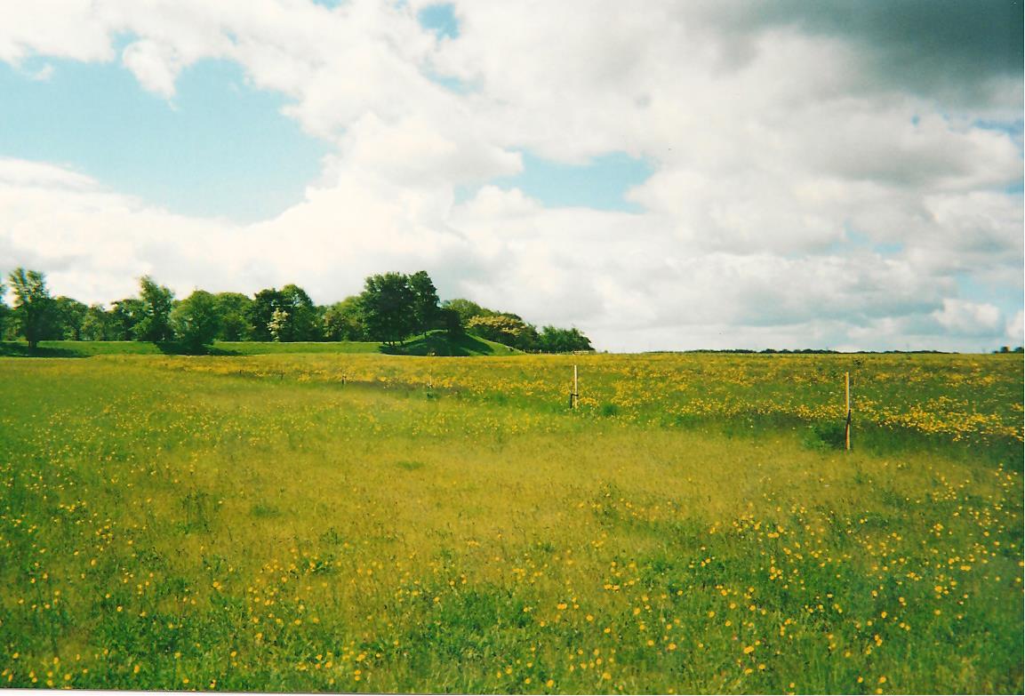
That autumn (2001), the Orchard was sown with a wild flower mix.
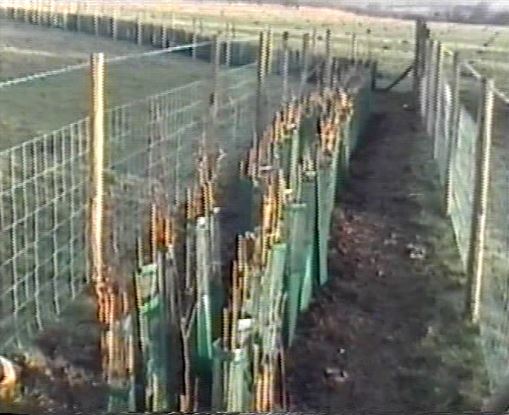
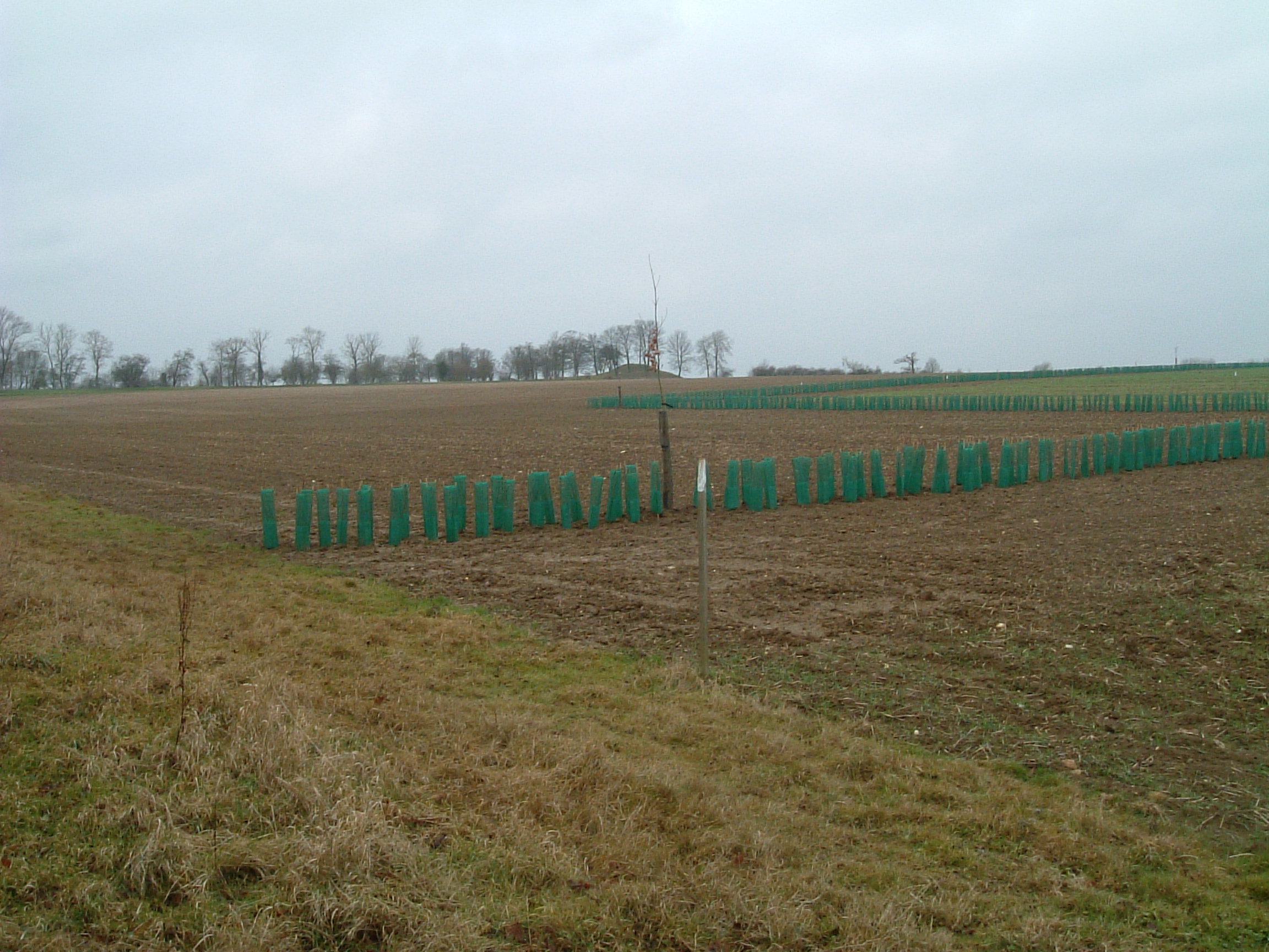
 During the winter of 2001/2002 the hedge was planted
The fence and hedge to the west of Old Manor Green was erected and planted (as shown in the two images below) at the same time.
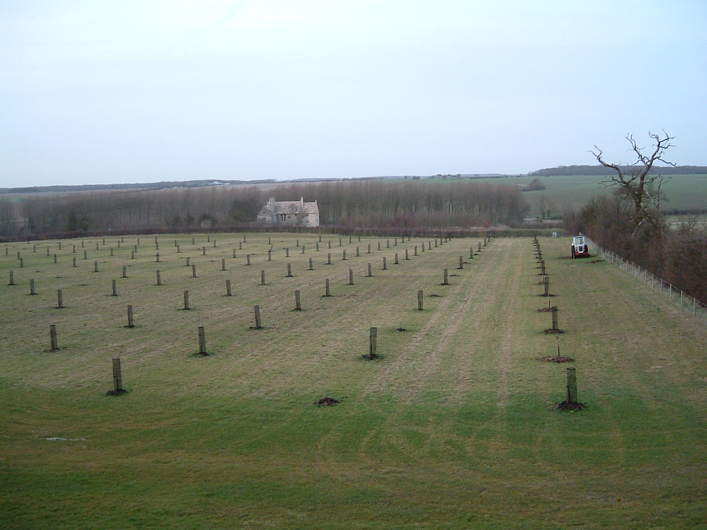
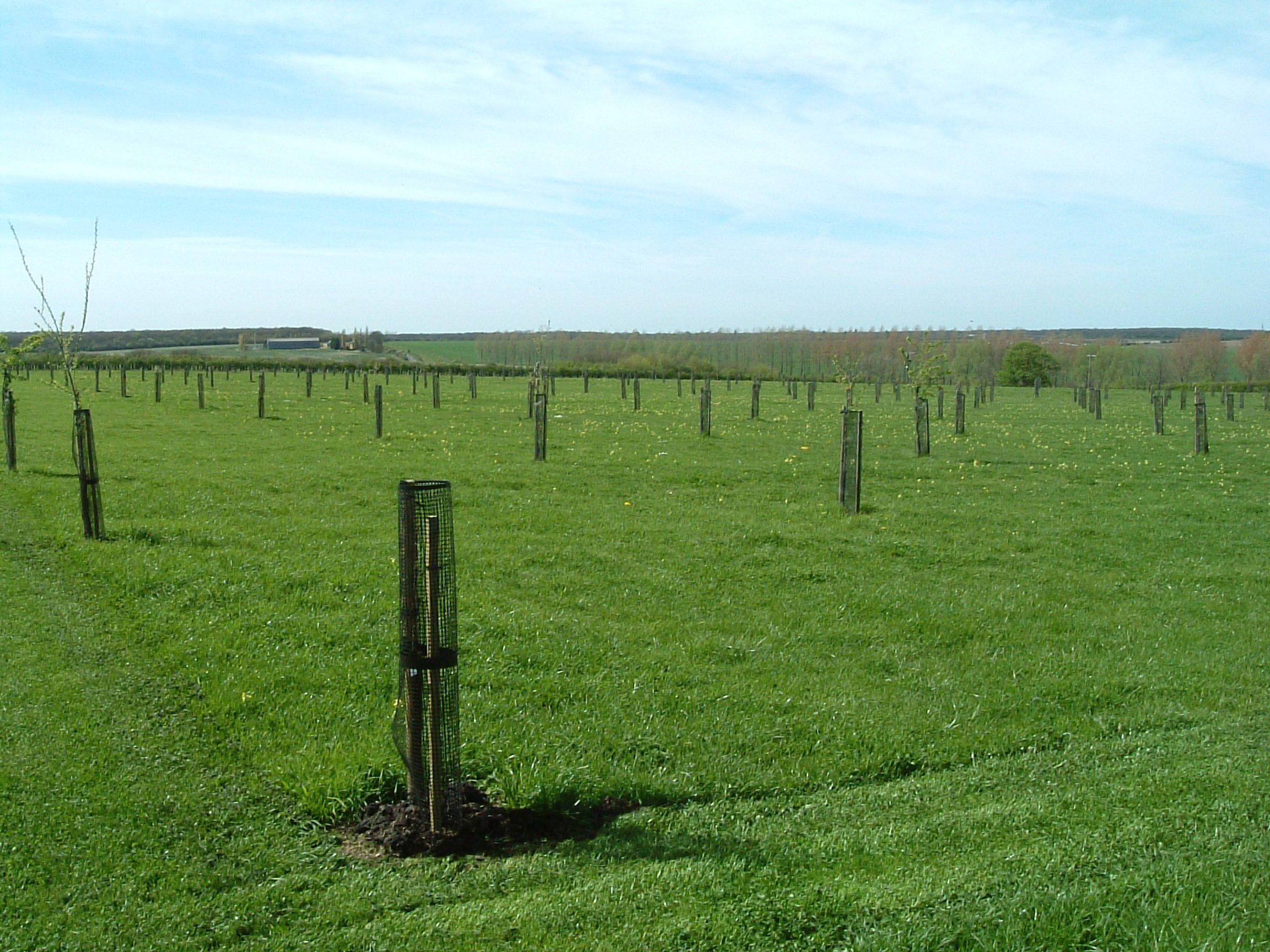
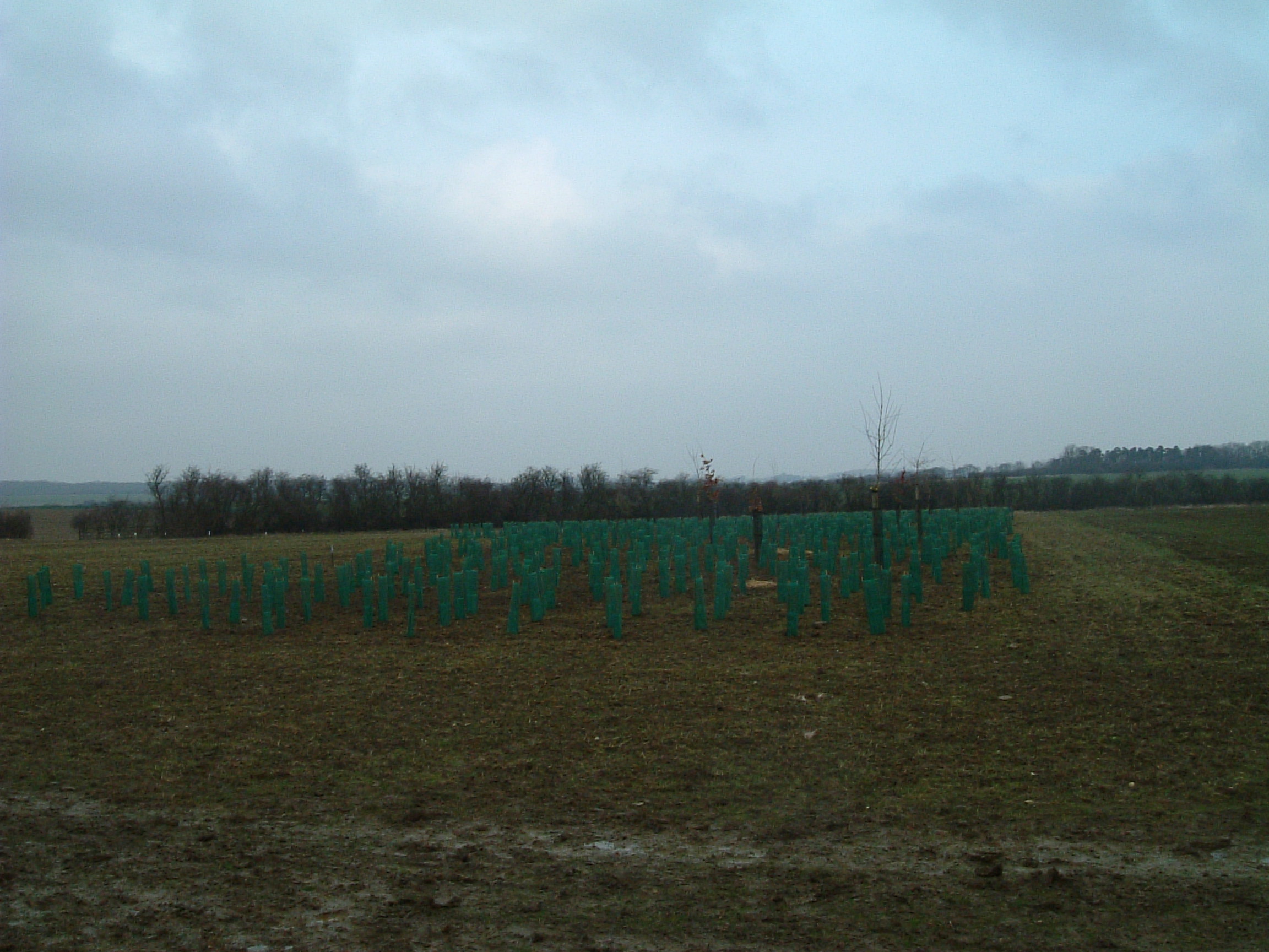
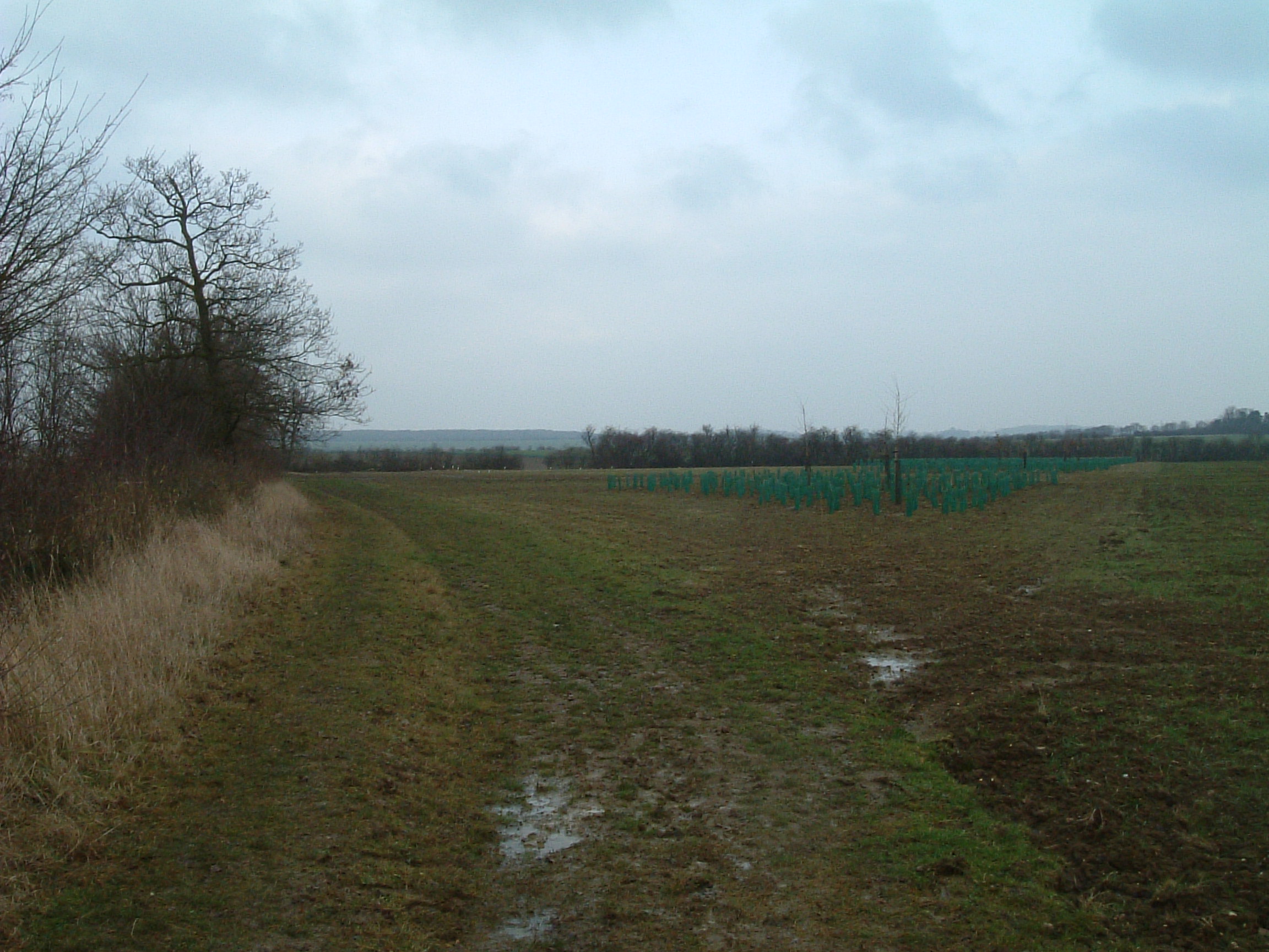
Re-establishing the orchard now became an achievable aim. A great deal of work had already been carried out to determine the tree varieties that had originally been planted in the orchard, and their layout. This work now continued apace, and in the same year, the field was marked out to define the planting arrangement based on that earlier research. About the same time, tree saplings were ordered from Brogdale (home of the national fruit collection).
Over the winter of 2001/02, all the planting points were augered out (to a depth of 15-20 inches), and then re-filled with a mixture of the existing soil (mainly clay) and farmyard manure.
By the spring of 2002, the wild flower mix was putting on a good show.
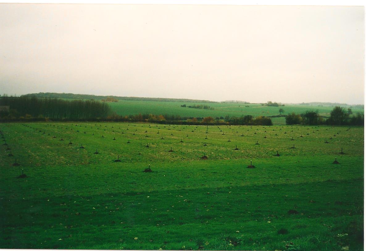
Delivery of saplings started in late 2001, and by March 2003, many of the trees had been planted.
Planting the first tree was ‘caught’ on camera:
Due to the rarity of some tree varieties, it was not until the winter 2005/06 that planting was completed and all trees guarded.
Outer Meadow
“In 2001, the Outer Meadow (together with the orchard) was seeded with a wild flower meadow mix from Miriam Rothschild’s estate at Ashton – not as pure as the Emersgate wild grassland mix, but a good local meadow mix.”
Re-planting the eastern hedge is described above in the Orchard section. Similar to the Hay Meadow, this meadow was left to grow during the late spring and summer months, before a hay crop was taken in late August, followed by sheep grazing during late winter/early spring.
Parterre Area
Reports by respected field archaeologists (the Taylor and Brown report of 1972) and an earlier 1930s report records the existence of ‘gravelled walks’ to the north of the Lodge. These ‘walks’, in the form of a lattice pattern, are of a long lost garden feature which is believed to have been there at the time building work stopped. Unfortunately, the drawings and their dimensions given in these reports are not consistent.
In late 1990 (or was it 1991?), Mark came to an agreement with the Duke of Gloucester’s Barnwell Estates for the use of a strip of land in which to mow a lattice pattern, now referred to as the ‘Parterre’. The pattern (a pastiche of the original) was mowed using a garden mower, and is shown on ‘Map3’ above.
A few years later, it was realised that the pattern being mowed was not a true depiction of the 1605 original. This story continues in section ‘Extended Parterre Area‘ below.
Second Phase – Access & Parking Improvements.
The additional areas described above, were acquired under leasehold agreements with Barnwell Estates. These acquisitions were soon followed by negotiations for additional land, primarily designed to resolve the on-going parking issues In 2002, “we considered buying land down at the bottom, but we thought break-ins might be a problem.” This concern, together with likely problems associated with restrictions due to the earlier archaeological excavations in that area, caused the idea to be abandoned. By 2007, parking problems became more acute. A solution was identified involving the re-instatement of “a hedge (shown on the reconnaissance ‘photo) which marked a field boundary, and bring the car park into the area that we later discovered was known as Bradshaw Wood” (see map4 above). At the same time, if successful, these plans would acquire the Parterre Meadow which would finally move all commercial agricultural operations, and all vehicular movements and parking arrangements out of sight on the Lodge. Plans were drawn up, and discussions with Barnwell Estates to acquire a lease agreement on the additional land required to implement this plan were started in 2009.
Unfortunately, these negotiations coincided in 2010 with plans by Barnwell Estates to construct three wind turbines on land some distance from the Lodge, but in full view. “The National Trust, along with a number of other local authorities, strongly opposed these plans.” Over the next four years, a great deal of work was involved in developing and putting forward the arguments against the plans; obtaining legal advice; and mobilising the opposition.
The local authority rejected the plans, so the developers took the case to the Planning Inspectorate which, in 2012, overturned that rejection, and approved the plans.
“I had a meeting with Lyveden’s Land Agent (Rachel Walker), and Barnwell Estate’s Land Agent (John Elliott) at their office in Bicester. We had just manage to get this land upgraded from grade 2 to grade 1 on the ‘register of historic parks and gardens’. John was obviously very angry at the Trust involvement in opposing the wind farm project. He said he wanted all the [current leasehold] land back again, and the Trust would be required to take out all the hedges, all the orchard trees, and put it all back to the state before taking the lease.
“We then got Fiona Reynolds (then Director General of the National Trust) and the regional director involved. Appeals were made to the Duke of Gloucester, and the whole saga went on for another 18 months.
“The Trust then got a phone call from the Duke to say that they’d identified land elsewhere that they could bring into production, and therefore he was willing to end the lease on the Lyveden property, and agree a sale of that land (both the land already held under the existing lease agreements, and that required to complete the proposed new car park) to the Trust at a price of £10,000 per acre.
“With central support, within 6 weeks, the Trust raised £400,000 to buy the land. This purchase included the rest of the Parterre Meadow, and the land to the east of the existing property which was to be used for the car park, and the new road giving access to the car park.” These acquisitions were completed by 2011.
The appeal against the wind farm continued. That decision of the Planning Inspectorate to approve the plans was appealed to the High Court, on the grounds that the Inspector did not give due weight to the effect of the plans on the local historic environment. That case was won, and the High Court overturned the decision of the Planning Inspectorate. The developers then took the case to the Appeal Court, which upheld the decision of the lower court. At that point, the developer had the option to submit new plans, and start the process all over again – fortunately, the likelihood of losing yet again, resulted in the decision to abandon the proposal, ending the ‘roller coaster ride’. “This case had an impact in changing case law relating to decisions regarding planning applications in that considerable weight and importance should be given to protecting the setting of historic assets. The Lyveden case has now been cited in many planning application decisions, not just for wind farms, but also for other developments.”
“This case was reported in the national and local press, on television news, and it really helped to elevate Lyveden as a significant site of historic importance. It was publicity (and good publicity at that) which we could never have achieve on our own.”
At the end of this phase 2 (c2011), the area of land now owned by the Trust is shown on map4 above.
New Access Road, Car Park, Bradshaw Green & Plantation
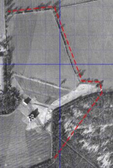 The Luftwaffe image, and specifically the section shown here, was used to determine the location of the hedge which marked the boundary of ‘Parterre Meadow’. The section of hedge on the north side of ‘Parterre Meadow’ still existed, but the eastern section of this hedge (together with many others), had been removed a few decades earlier.
The plan was to re-plant this hedge on the original line, and construct a new access road (now known as ‘Park Lane’), outside this boundary.
The area to be used for the car park, and the associated meadow and planting area (‘Bradshaw Green’ & ‘Bradshaw Plantation’) was established by taking a straight line from the east side of the planned new road (where it passes through the hedge into this area), across to the eastern edge of the Lyveden Way footpath where it turns west around the Hay Meadow boundary hedge.
 Having defined this new boundary, in January 2008, a new hedge was planted on the line of the old hedge. The image on the left was taken from the northern end of the new hedge looking south-west toward the Lodge.
The photo on the right, was taken from near the southern end of this hedge, looking north-west, with the ‘East Pyramidal Mount’ in the distance. The new boundary is shown by the post with the white painted top. The new road will be constructed between this boundary and the hedge.
To the left of this second photograph (not shown) is another old hedge, and drainage ditch. A short section of this hedge was removed and a culvert constructed to give access into the area to be used for a car park.
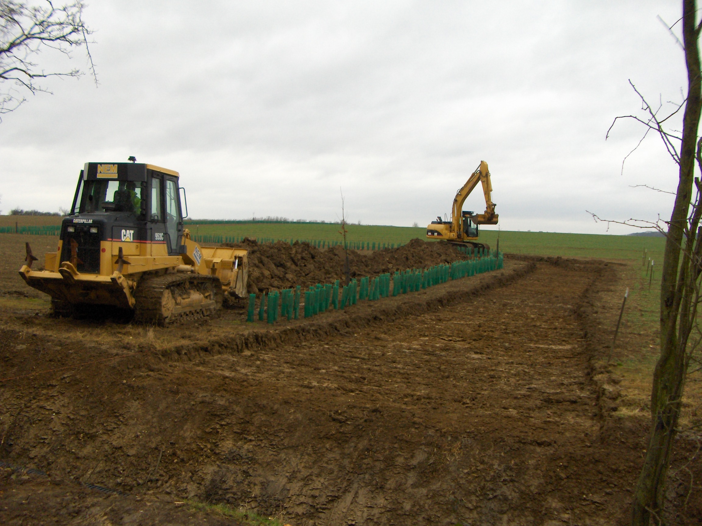 This recently discovered photograph shows the start of road construction during top soil removal, but before the culvert was installed (the cleared hedge and ditch can be seen at the bottom of the photograph).
According to specification documents for this work, and related plans, it would appear that the Trust’s boundary would extend a nominal 10 metres away from the centre of the hedge line. Of this, there would be a 2 metre inner verge; the track would be 3.5 metre wide; and then a further outer verge of 4 metres. The document also specifies that in 3 places, and for a length of 10 metres, the track will widen to 5 metres (for passing places). In the event, only 2 passing places were constructed, and both inner and outer verges were 2 metres wide. Perhaps this change was agreed to reduce costs?
For the road itself, the old field surface was dug out to an average depth of 350mm, and the spoil spread over a large area of ‘Parterre Meadow’, which was then re-seeded. The road was then to be constructed using various compacted layers of graded aggregate, and topped with granite chip.
The topsoil over the new car park area was also dug out (to an average depth of 200mm), before building up the stone base and adding the surface grit. In this case, the spoil was spread over the ‘Bradshaw Green’ area.
‘Bradshaw Plantation’ was designed to provide a natural barrier between the new park area and the arable field beyond. In addition, the plantation was expected to eventually act as a representation of Bradshaw Wood prior to clearing, and give the feeling of a wooded enclosure around the Bield.
Planting was carried out using hedging whips of hawthorn, hazel, guelder rose, and field maple, together with a number of 1-2 year old oak seedlings raised from acorns by local school children. A quantity of standard oaks and field maple were also planted. It is worth noting that a pipeline crosses this area, and planting of standard trees within a few metres of this fuel line is not permitted. An inspection soon after completion of the planting identified two or three trees that had to be dug out, and re-located!
The bridleway across to Lilford Wood used to be ploughed with the rest of the field, which meant that, “for much of the year, it was in a terrible condition, and if you walked across there, you’d get your boots stuck in that”. In the late 1990s, “we got them to leave it as a grass path, and when we constructed the new car park, we sort of, extended the apron of the car park into that area, which was a particularly wet area. We could have stoned it right across if we had the resources”. This part of the bridleway became part of the new ‘Lyveden Way’ from Wadenhoe to Brigstock Country Park (see the ‘Local Interest‘ page).
Extended Parterre Area
The original parterre pattern being mowed is described in section ‘Parterre Area’ above.
 In 2006, following the discovery of the Luftwaffe reconnaissance photograph, it became clear that the original 1605 parterre was significantly larger than that then being mowed. After the acquisition of a larger section of the Parterre Meadow in 2008, two or three attempts were made to create a more realistic depiction of the parterre based on this aerial photograph. Finally, in 2017, a version based on repeating 90′ x 150′ sections to make up the lattice, was chosen which closely matches both the photographic evidence, and the conclusions of the Trust’s archaeology advisers. This final version is shown on ‘Map 4’ above.
Third Phase – Acquisition of the Manor House (Old Bield).
Very soon after completing the negotiations for Phase Two above, Mark heard that the Manor House was for sale. The Trust’s Regional Director (Becky Speight) was coming for a visit, and Mark mentioned that it was for sale, “and that it would be an amazing acquisition to create and own the start of the Lyveden journey, not just the end of the journey, but the asking price is £1.8M.
“The Trust were very supportive of the purchase of the property, particularly its assessment of the acquisition criteria – this being that the property was significant; that there was a threat to the historic value of the site; and that it was a financially stable proposition. The significance was not disputed because it was a grade 1 listed building, and in addition, its had a direct relationship to the New Bield and Gardens. The threat was that if the Trust didn’t acquire it, then as had happened with previous owners, new owners could cause untold further damage to the building and the surrounding area. Meeting the ‘financially stable’ criteria was more of a challenge, but the Trust were willing to support the proposal. This was particularly encouraging after we had just spent a significant amount of money acquiring the land around the existing property which was previously leased from the Duke of Gloucester’s estate.” Eventually, the Trust put in an offer (sealed tender) to the vendors, after which we had to await the outcome of the bidding process.
During that waiting period, Mark discovered that as owners of the New Bield and Elizabethan Garden, the Trust had right of access to use a route passing through the hedge between the Orchard and Manor grounds, following a line close to the hedge between Manor Meadow West and the West Garden, and eventually coming out onto Manor Avenue. At the time, there was no gap in the hedge, or identifiable path. With the thought that it might discourage other potential bidders to see strangers walking through their grounds, a gap was cut in the hedge, and a path mown. It is not now believed that this had any effect on the outcome.
In 2012, the Trust’s offer for the purchase of the Manor and grounds was accepted.
We then discovered that “There was a covenant on the property restricting commercial use. Fortunately, we were able to negotiate with the Duke of Gloucester and his agents for a lifting of that covenant”.
“It was amazing how quickly the Trust took to the idea of purchasing the Manor. The benefits and opportunities to now complete the Lyveden story, and to massively improve the visitor experience, are what we always wanted.”
At the end of this 3rd phase (late c2012), the area of land under the control of the Lyveden team is shown on map5 above, and extends to 44 hectares (approx 108 acres).
For the future, the “concern is that you’ve got to ensure that the landscape is sustainable if the visitor numbers are to increase to between 80,000 and 100,000. It’s a very fragile landscape and will probably require a structure of walkways and paths to keep visitors away from the primary features, while still ensuring that they are able to see and appreciate the Elizabethan garden. Even at current numbers, there are signs of wear that begin to detract from the sharpness of the original design.”
“The other challenge, which has always been the case, is the ground conditions, which are extremely wet. How that problem is overcome will require a lot of thought and probably some significant cost, to provide access using hard pathways and without ruining the overall ‘Spirit of Place’ of the site.”